Monday, August 28, 2006

a tale of two cities - the historic link


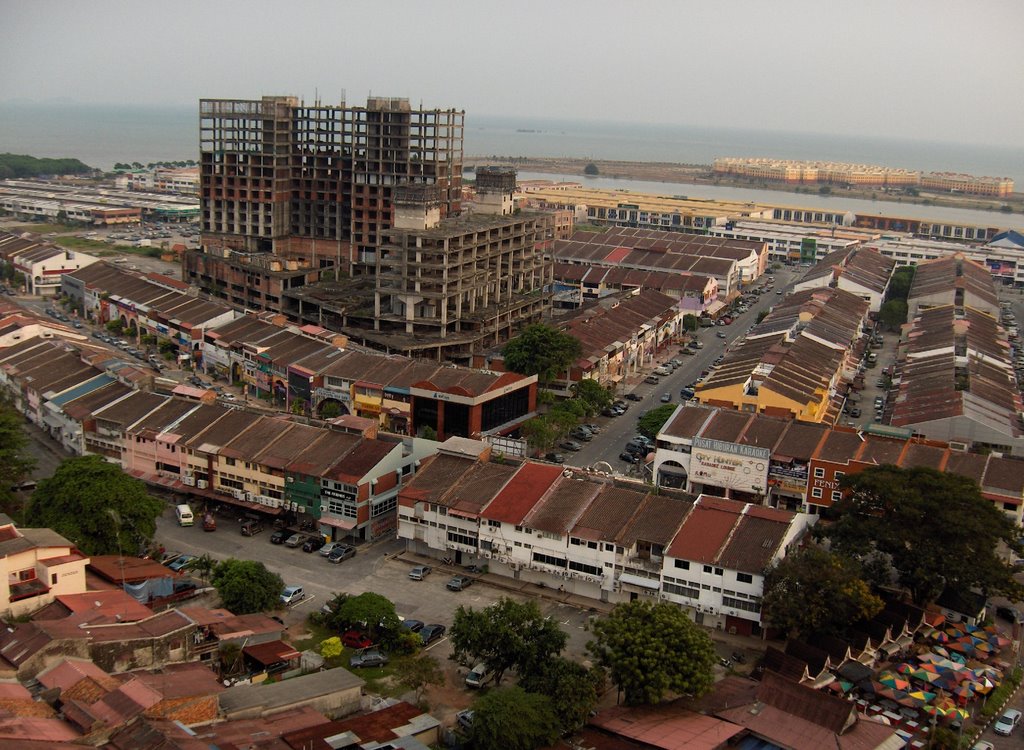
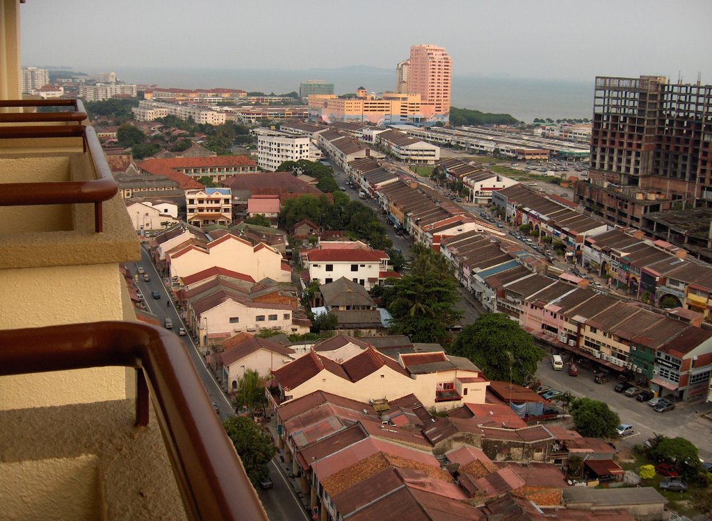
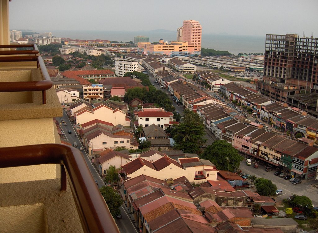
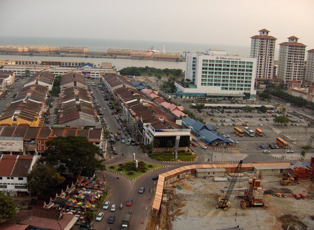
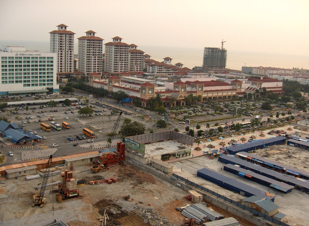
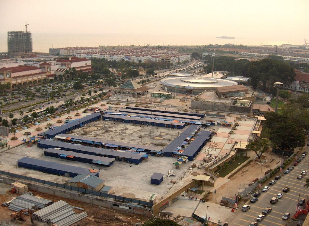
These views of the historic town of Melaka were taken on the evening of 24Aug2006 from the 16th floor of Hotel Equatorial. On the right is St Paul’ Hill, & towards the left is Jalan Parameswara where the hotel is located. The greater part of the bay area is land reclaimed from the sea which is part of the Straits of Malacca. Coincidentally, Dataran Mahkota, with the round building compassed by the construction site towards the right was advertised in the Saturday’s Straits Times as an investment opportunity.

Imagine, half a millennium and more or so, out in the sea, this would had been a very busy port. From the late 14th century with the founding of the Melaka Sultanate and over next three centuries, Melaka the main port of call in South East Asia.

Atop St Paul’s hill is a statue of St Francis Xavier, the Jesuit priest whose memory is also enshrined in the park in Oita Japan. (St Francis Xavier & land of the Christian Daimyo) .Francis Xavier came with the Portuguese conquistadors with the mission of spreading the good news to the non-believers living in Cathay and Nippon. He stayed at the St Paul’s Cathedral atop the hill, where the hill is now named after. On his onward journey to the far east, Francis Xavier also mentioned in his notes that his ship stationed at the mouth of the Kallang River.. A copy of his notes could be seem at the Asian Civilization Museum, Elizabeth Place.

Before the Portuguese came Melaka, or Malacca till her name was officially changed, was the premier port of call in the Malay Archipelago and it was also where the Melaka sultanate began some 600 or more years ago. The Portuguese records had it that - ‘Parameswara a prince from the Sumatra royal house was fleeing from the Javanese masters. The ruler of Tumasik, Gamarajah welcome him. He was more interested in piracy than in trade. However he later murdered Gamarajah and took over the throne. The murdered ruler was a relative of the Thai overlord, who was angered and sought revenge on Parameswara. He escaped overland and founded another great city – Melaka’. (Source: the defunct - Singapore History Museum @ Riverside Point)

How closely is history intertwined and what it was eons ago maketh what we are today – as the saying goes 无古不成今 – without the past we would not have been what we are now. Tumasik, name of ancient Singapore before Sang Nila Utama set foot on this island and founded the Lion City, was the heart of the Singapura Sultanate 700years ago. It was a busy trading port with traders coming from Sung China, Arabia and from the regions.

As it is where a replica of the palace of the Melaka Sultanate is build on the foothill of the of St Paul’s hill near the mouth of the Melaka River, the palace of the Singapura Sultanate was located at Fort Canning or Bukit Larangan – the Forbidden Hill - near the mouth of the Singapore River. Singapura as a trading post faded into history after the murder of Gamarajah and the baton was passed on to Melaka.

The Melaka Sultanate was at its zenith in the early years of the 15th century. In 1405, the Ming Admiral Cheng Ho on its maiden maritime expedition – 郑和下西洋 - call at this port. There is a temple and a well named after Admiral Cheng Ho in the city. The expeditions also left behind a rich and unique legacy – the Peranakan, the Straits born culture. The peranakan cooking, the nyona delicatessen is very much a part of our daily food menu, and it has truly spiced up our lives.

Melaka fell to the Portuguese in 1511, and subsequently she was under the rule of the Dutch and then the British. When Raffles landed in Singapore in 1819, and rejuvenated the island that was in slumber for 600 years, the earliest batch of migrants that came to this island was the Peranakan’s from Melaka.


-//-

Monday, August 14, 2006

the gorgeous artist - xintiandi

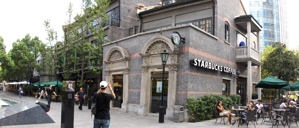
A scene taken from Shanghai - Xintiandi, (新天地)4Aug06, Friday. 4:15pm.

This gorgeous artist was seated at the alfresco bar sketching the patio of the old mansion.
She was wearing a flowery bareback dress with spaghetti string, with a chic bracelet on her right hand, and had a nice make-up. Her lightly dyed hair was bundled up to expose a revealing mole on her shoulder. She seems engrossed in her work, but on second look, it seemed incongruous –wasn’t she overly dressed for her pastime. She didn’t look like a tourist, though.

Could she be from the local art school or the architecture college.? I didn't disturbed and asked her, though she would most probably have obliged with an answer. Anyway, she was dressed to her ninth, and would be heading to a party next after she finished her sketch. She was another sight to catch in addtion to the architectural gem in the the Shikumen (石库门) in Xintiandi.

The Shikumen in Xintiandi is described in the tourism brochure as ’a reflection of Shanghai historical culture in architecture, and a manifestation of the famous ‘Hai Stream’ civilization. (海派文化的集中体现). This is a touristy spot - like the Boat Quay in Singapore - a must for visitors to modern day Shanghai. Instead of merchant houses and godowns by the Singapore river, these were apartments build during the turn of the 20th century.

‘Hai Stream’ architecture is a uniquely Shanghai genre which has a blend of Shanghainese and western elements on the city architectural style as the city opened up to foreign influence. The equivalent in Singapore would be what the Straits architecture was.

Shanghai was one of the five ports opened to British trade by the Treaty of Nanking (1842) after China was humiliatingly defeated in the First Opium War. It prospered quickly and countries such as France, Great Britain, and the United States all held large concessions in the city until the early 20th century.


Nanjing Road (East)


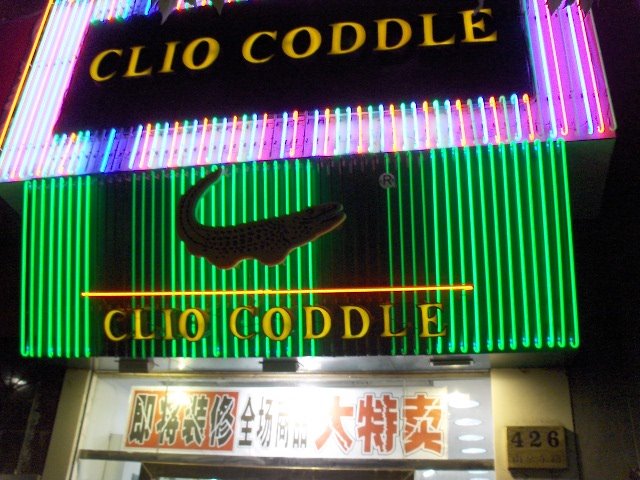
One of the shops at the premier pedestrian shopping mall in China, Nanjing Road - the Orchard Road of Shanghai.


The ‘buaya’ looks familiar - Crocodiles for sale, in Lacoste green! As they say - one stone shoot two birds.


-//-

Saturday, July 08, 2006

uniquely Japanese - the Yamato discipline

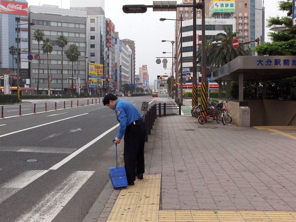
This picture is taken outside the Oita station, and the person sweeping the sidewalk is a guard manning a building near the station. It’s early in the morning at 6:00am, and he had a broom and a bin with him sweeping up litters - cigarette butts and what have you. These little scenes of public spiritedness and discipline is still much the norm in this modern yet traditional society.

The Japanese is well known for its discipline and community spirit. Though, the majority of the population lives in cities, however beneath the veneer of modernity and high tech one finds a highly disciplined community of people who keeps their tradition and culture. A 20 minute by bullet train from the center of bustling Tokyo would take one to the outskirt where there are plots and plots of neatly cultivated rice fields. And in the midst of the fields and the farming community one would find the most modern high tech plant - making the chic digital camera.

Since its modernization drive in 1876 which began with the Meiji Restoration when Japan decided to open up to the world, it has absorbed the best of the west in hard sciences and continued to keep its tradition and culture. Over ther 130 years since, there runs in the society a symbiotic cord of modernity and tradition that is uniquely Japanese – a Yamato (大和) spirit of samurai discipline and an orderliness & perseverance nurtured by an agrarian society that often has to fend off earthquakes and typhoons.

Be it the rice fields or the state-of-the art high tech plants, they are run and managed by a people who is disciplined, orderly, and hierarchical. And out of discipline and orderliness is a society that produces your Lexus's, Cefiro's and Ixus's.


Sunday Mart - Shinjuku Central Park

If you know where to hunt, bargains are still available despite the exorbitant prices in Tokyo.

The Sunday morning mart beside the park in Century Hyatt Shinjuku. A dvd could be had for Y100 ($1.39)

Fertility shrine

A two and a half hour train ride from bustling Tokyo by the North-east Shinkansen takes you to a beautiful hot spring resort located in the mountain set amidst lush green rice fields (http://www.oosawaonsen.com/). Located in the hot spring is a fertility shrine revered by the locals.

Fertility shrines honoured in the Shinto style tradition. This shrine is decorated with white folded paper and a big rope made of rice straws hangs at the entrance. A smaller straw is draped around the object of veneration. Shinto shrine is made from wood which typifies nature, and usually set in the woods.

When Singapore was Shonan To during WW II, a huge Shinto was build in the woods in McRitchie Resvoir.

-//-

Wednesday, June 28, 2006

St Francis Xavier and land of the Christian Daimyo


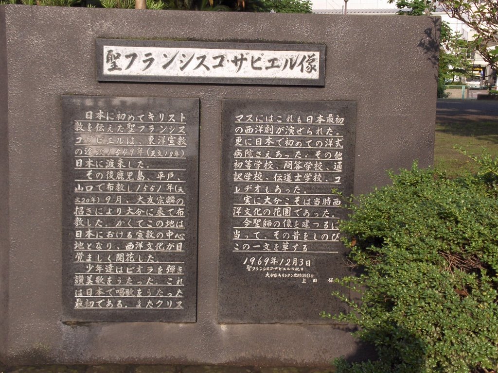
St Francis Xavier at the invitation of the Christian Daimyo, Ootomosorin (大友宗麟)arrived in Oita in September 1551 to preach Christianity. Oita the capital of Oita Prefecture is located in the north eastern part of Kyushu island.

This statue of the Daimyo stands in front of the Oita train station.

St Francis Xavier was one of the earliest missionary to spread Christianity to Japan. On his journey to Far East the Jesuit priest wrote in his diary that he stopped over in Singapore, and the ship that he was traveling in docked somewhere out in the mouth of the Kallang river.

The Daimyo or feudal lords in Kyushu played an important role in Japan history and the introduction of western civilization to Japan. It was in the order of Lord Otomosorin that the 12 year old Ito-Don-Mansyo went to Rome to learn Christianity. This boy was the first Japanese to travel to Europe in the16th century. The feudal lords from this island also played a crucial role in modern Japan with the Meiji restoration in 1876.


This statue of St Francis Xavier is located in the park opposite the ruins of the castle in Oita.


ANA Hotel Oita Oasistower / 6:30am-JST

Monday, April 17, 2006

the expatriate artist

It was a Sunday morning on my usual routine. After gym headed down to Amoy street for my favourite changgen (肠粉) stall, after which a stroll thro the time tunnel thro Telok Ayer Street.

This stretch of road & the adjacent Amoy Street and Angsiang hill never fails to fascinate me, with its rich history - temples, mosques, clan associations - it has a never ending story to tell. The old shop houses have been reinvigorated. Where it used to be opium dens, you now have the lastest craze there - a yoga center.

As I was walking past, I saw a young man sitting in front of the shop lot, which is now a restaurant offering grandma's favourite cooking, absorbed in drawing the historical gem opposite him. I went over and chatted with him.

'Subarashii!' I said, meaing amazing in Japanese. He had on the postcard the side gate of the Thian Hou Temple beautifully outlined. He started off by sketching with his pencil, and drew the final in fine ink pen. I was amazed by the neatness and exactness of the drawing, and compared to what I've been sketching it was so much more professional.

He said that he is an expatriate architect from Japan. He had been sitting there for the past two and half hours since 10:30am drawing on the postcard. He said that he has been sketching since coming to Singpapore not so long ago, and showed me his master pieces in the sketch book that he had with him. It has the Shangrila Hotel, old shops in Bukit Batok where his condomium is, Wheelock Place, etc, all neatly draw. He said that he will touch up the drawings with colors and then send them as postcards back to his family in Tokyo.

I asked if I could take a picture of his drawing. He politely obliged and was very modest of what he has created, in the usual Japanese humbleness. He held up the picture for better lighting effect. I've met a number of foreign artists drawing the local scenes - historical & tourist sites -most of them are Japanese. They would draw in pen or pencil with and the sketch book as part of their travel gear. One of them commented to me that thro drawing he would be able to aborb the details of the building and site, and not just snap it with a camera. The local artists would usually paint in water color or in oil.

This encounter has brougt me new ideas and greater inspirations to draw. I could not wait to look forward to my next drawing session, and the weekend jouney thro history.


-/--

Saturday, April 15, 2006

a Good day for reflection

It was a cloudy Friday morning and traffic was smooth as it was a holiday. It was a holy day for the folks who go to church. When I saw them carrying palm leaves last Sunday, I realize that the Good day will be next, and was planning on what to do for the long weekend.

After breakfast I headed down to Hill Street. As the it was early and the gate was still locked, I had to climbed over the gates and sneaked into the compound of the Armenian Church.. In the quiet of the of the garden, I found a comfortable spot on the green an began my sketching.

Though there were no churchgoers to this 171 year-old church on this holy day, in the garden I saw some bronze statues depicting scenes of judgment by the Roman official, and of suffering bearing the heavy cross. It caused me to reflect and ponder this day of penance on some major world events, and other significant happenings.

In the West the clash of civilization is supposedly on the rise among the people of the Book. The latest find of the Gospel of Judas, though not a new revelation, has caused a stir among the holy community. Half way around the globe closer home and in the supposedly heaven on earth city of Hangzhou a milestone event is going on. It was the first time since the communist rule came to power in 1949, that a religious forum was organized by the religious communities on both sides of the straits, and sanctioned by the mainland government. Participants came from 34 countries world wide - from both the academic and religious organisations. Be the event to put the communist party in a better light, the dharma wheel is set into motion again in this ancient land, and a hope for peace in diversity.

It started to drizzle a little, and the stomach said that it was time for lunch. After a three hour sitting on the green the legs were all numb, and it jerked me back into the real world. It was a meaningful morning spent. I had the church in my sketch book to take home to adorn the wall.


-//-

Friday, March 17, 2006

the mountatin resort above the valley

The distance from Ipoh to Tanah Rata using the highway off Simpang Pulai is about 95km odd, and it took me an hour and half to reach there. This stretch of highway opened a few years ago, and it has halved the distance to the resort by traveling the old road from Tapah.

The highway up the mountain is wide and less winding than I had expected. The drive was pleasant, and there was not may steep climb along the way. Though certain sections of the roads were very close the mountain slopes and a stretch of it was under re-construction because of a landslide.
At the junction at Kampong Raja, one turns right turn, and soon will reach the resort proper with Brinchang at the highest township at over 1,600m. Traveling by the old road and heading from the south from Tapah, one would reach Ringlet, then Tanah Rata and then up to Brinchang. However, driving from the north will lead you straight to Brinchang.

The three townships make up what is popularly known as Cameron Highlands. It is named after William Cameron, a British surveyor who stumbled across the highland plateau on a mapping expedition in 1885.

The journey up was a pleasant morning drive and there were only a few cars on the road. It was a fine day and stretches of road was enveloped by the morning fog. The misty mountain air gave one the feeling of being in a dream like world. The view was spectacular, and it’s exhilarating to be in the folds of the mountain.

The air got cooler as one climbed higher. One could see Orang Asli (natives) settlements on the hill slopes. I saw them from the highway, carrying long poles which could be blow pipes and heading for their morning hunt. The Orang Asli’s in this part of the peninsular are mainly from the Senoi tribe. Originally they were thought to have come from the hills in Vietnam, Cambodia or Northern Thailand, about 6000 - 8000 years ago.

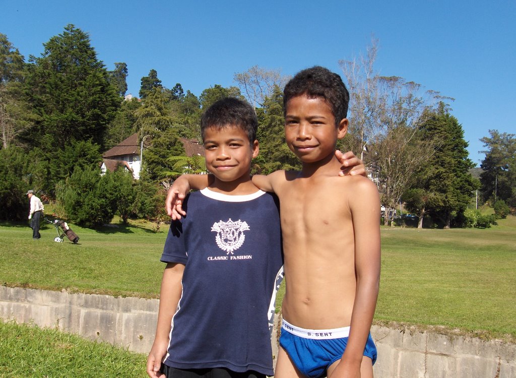
(photo: these two orang asli kids were playing in the stream in the golf couse at Tanah Rata. They spoke a language which is alien from Malay. The dad was caddying and they have a care free time in the open. When I asked to stand togehter to have their picture taken, the taller of the two kids asked me for RM10. Hindsight I should not have given them each with RM5)

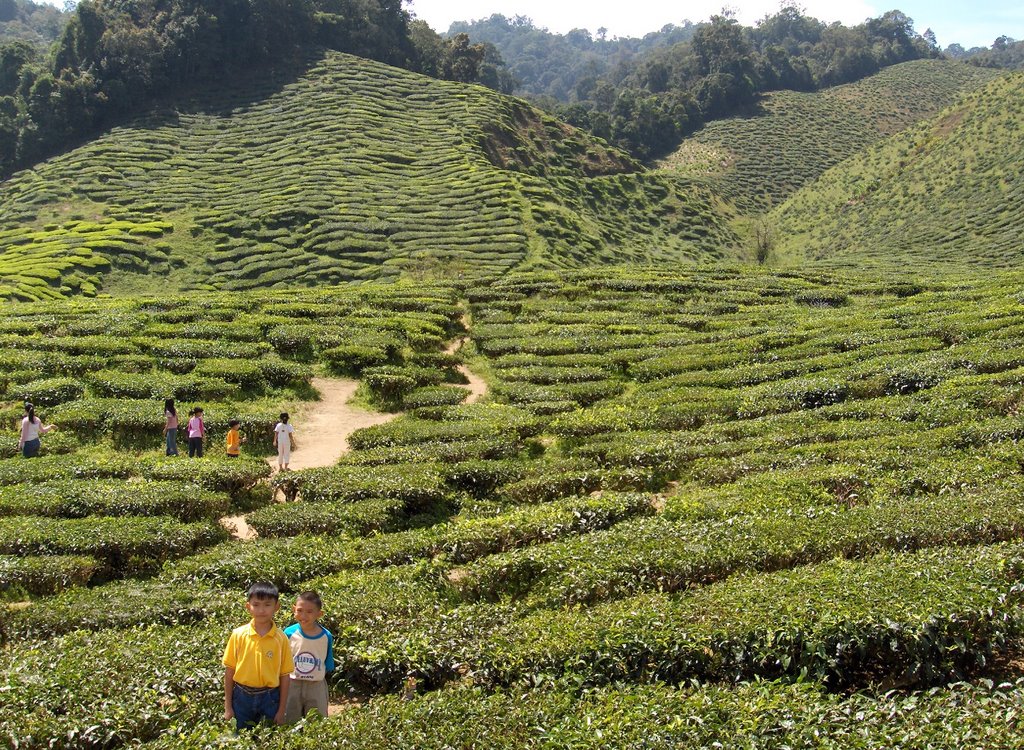
As on drove further up, vegetable farms, orchards and tea plantations came into view. One could stop to shop for fresh vegi, flowers or enjoy a cup of Cameroonian tea outdoor with the tea plantation in the backdrop.

Little did I realize that later when I reach the resort proper the road was chocked with traffic. Cars were crawling bumper to bumper along the narrow mountain road. As it was the 3rd day of the long CNY break, car loads of family members were up on the resort for the holiday break.

All in, it was a good trip up the mountain resort after a break of more than 20 years. With the new highway, the mountain resort is easily accessible from Ipoh. However a word of advise - never to go up the resort during festive holidays. The traffic jam could not be worse.


Tea plantation next to the highway, berfore Kampung Raja driving from Ipoh. It is open to public and the tea house serves tea in an open terrace overlooking the plantation.


-//-

Wednesday, March 15, 2006

the origin of the sandy river noodles

Last Saturday was at the Hong Lim Food Center, patiently joining the long queue of customers for a taste the Ipoh Sar Hor Fun. Though it is Ipoh Sar Hor Fun, the dish is prepared far from the way it is done in Ipoh.

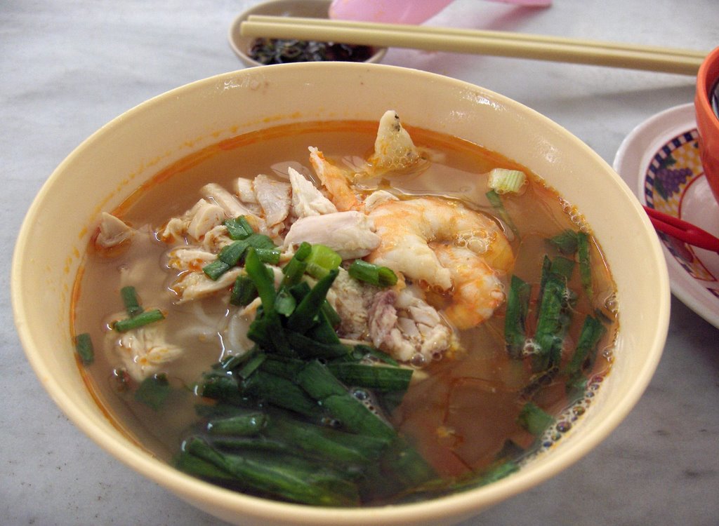
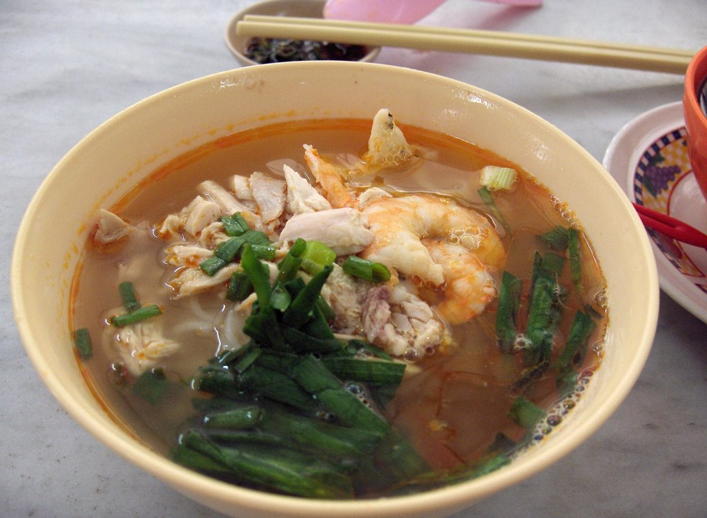
The noodles could be prepared in a variety of ways, and the most popular way done in Ipoh is to serve it in soup. The rich chicken & prawn stock has a thin layer of prawn oil on it that gives the white noodles a pleasant orangey look. It is topped with shreds of chicken and prawn meat and a sprinkling of chives (韭菜) . This method of preparing the dish is very different from the way it’s done at the stall in Hong Lim Food Center, which it is served dry in gravy and one could order it with crayfish and prawns, chicken and prawn meat, etc.

Why then is it named Ipoh Sar Hor Fun? This is because the rice noodle from Ipoh is reputed to be the smoothest, and this had to do with the water use for making the noodles. Its source is from the limestone hills that surround the valley town. Since then, the reputation of the noodle has spread far and wide.

Interestingly the name Ipoh - Sar Hor Fun (沙河粉) in actual fact is a composite of the names of two towns as its prefix, namely Ipoh and Sar Hor (沙河). Where then is Sar Hor?

We’ll many years back on my first trip to Guangzhou, China; I took land route from Hong Kong to the city. As the coach approached Guangzhout city proper, I saw a signboard with the word Sar Har (沙河)written on it. As the name in Chinese is the same as the Sar Ho - Fun back home, it triggered my curiosity. On inquiring, lo and behold!, I was told that this area is famous for it noodles. The name Sar Ho literary means Sandy River, and probably there was a river by this name that flows nearby. It then dawned on me that this place is the mother of all the Sar Ho Fun’s.

The early migrants brought with them the method of making Sar Hor noodle to Ipoh. And as they said the rest became history.

Interestingly, as the Ipoh Sar Hor Fun at Hong Lim Food Center grew in fame, it’s style of cooking could be imitated by other stalls and they would then adopt the name Hong Lim Ipoh Sar Hor Fun……Well, isn’t the Sar Hor Fun really fun!


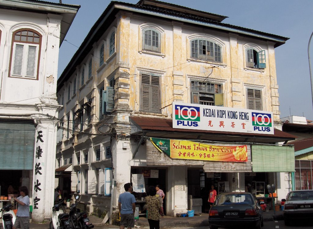
The original Ipoh Sar Ho Fun ( 天津茶室, 怡保)


Hon Lim Complex - Tuck Kee (Ipoh) Sar Ho Fun


-//-

Friday, March 10, 2006

a splashing sliding time in nutty town

Some time back in the autobiography of Frank Swettenham (Governor of Straits Settlement 1901-03) I read that he had visited the tin mining areas of Lahat and Pusing. The towns are located at the foothill of the Kledang range in the late 1800’s. (dawn in the year of the dog) . He was told that there were many waterfalls and steams around the area and the local folks would have picnics and enjoy ‘mengeluncur’ in the falls.

The Malay word ‘megeluncur’ means ‘to slide’ and most probably the folks had a splashing time sliding down the waterfalls and bathing in the cool mountain streams.

When asked where they were heading too, the local folks could have answered ‘Mengeluncur’, and subsequently it could have got evolved into Menglembu.

We’ll this is purely my own conjecture and hypothesis on how my hometown got its name. As it also sounded ‘lumpur’ or ‘lembu’, it could have been a muddy place or a place where cows once roam. The former seems unlikely as it was located at the foothill and the soil is hard and the river rocky and not a place to find muddy and soft ground. It is not early day Kuala Lumpur, which began life at the muddy confluence of the Klang & Gombak Rivers.

As to the name of the town linked to ‘lembu’ or cow, the early immigrants could have kept cows. In the early days, there was a community of Indians/Punjab who reared a big herd of cows near the foothills. In the morning and evening they would let the cows roam the foothills to feed on the grass. We used to order fresh milk from them. The milk was delivered in the F&N glass bottle. Each morning mum would boiled the milk and we;’ll have a glass for breakfast before heading to school.

As to why meng-lembu, I wonder why then would one want to make it an active verb with the prefix ‘meng’ connected to ‘lembu’. There are places that is named after cows such as Kandang Kerbau, (buffalo shed), but Meng-lembu seems not likely to have anything do to with cows.

Could it be a name of a fruit or a three which I have not heard of, a local term for a animal? I have yet to find out. But for now, I will keep to ‘mengeluncur’ as it sounds the closet to Menglembu, and the town next to it seems to suggest this is so.

Further south along the range about 3km away is the town Pusing. It is located much near to the foothill, and the word ‘pusing’ in Malay means to turn around as in direction.
Pusing is located right at the foothill, and if one does not intend to climb the hill, he’ll have to make a U-turn back.

The locals would have gone to the hill ‘mengeluncur’ , have fun sliding in the waterfall, and on reaching the end of the range, ‘pusing balek’, and turn back to return home.

During the Japanese occupation in the 1940’s Pusing wa a important gateway for the Anti-Japanese guerillas to their jungle hide-out. The WW II hero, Lim Bo Seng and his fellow 136 infiltrators would have visited the town. The SBC tv drama ‘The Price of War’, had the location in Pusing, casting of James Lai, as the war,hero.

Menglembu, being small town, I was in doubt if I could find its name in the web. Well, to my big surprise, its name appeared as the world renowned - Menglembu Groundnuts! (nutty)

It was no wonder that a few years back the Ipoh Municipal Council built a big & unsightly model of the groundnut at the northern entrance to the town. They should have been more imaginative and considered a Big Splash instead.


friendly folks! nutty coconuts!

update: 15Mar2006

It could not have been more coincidental. After this blog was written, I laid my hand on the Coffee Table Book published by the Perak Academy, ‘Kinta Valley, Pioneering Malaysia’s Modern Development’, and it helped answered the question that had always been on my mind – how Menglembu got its name.

In the book there was a chapter on Kinta Towns, and an article on Menglembu. It read ‘It is possible that “Menglumbu-Tekah, was originally a pastoral area. Tekka means a Muslim prayer-house and Menglembu probably refers to cattle-herding carried out by Pahan migrants from Afghanistan...'. It now seems that ‘lembu’ is the more likely the hypothesis for the origin of the town’s name.

The Pusing town mentioned above should have been Papan. Sybil Karthigasu, the WW II heroine of Ipoh, had her clinic there. The town was also visited by Sir Cecil Clementi Smith in 1889, which indicated its importance as a center for tin mining activities then. Papan started off as a logging town, where the Malay word means plank. It was one of the oldest towns in the Kinta valley where the Chinese community migrated. In what the book called Papan a cul-de-sac town, it is now a quite and desolated town. When the tin industry collapsed in the 1980’s, the large number of the young folks went to Japan, or re-migrated to the US, in search for jobs.

As to how Pusing got its name, the book wrote, ‘The place was named Pusing because there was a lotus pond (kolam teratai). So the water was used by them to wash the ore. The waster was turned around and channeled back into the pond and re-used’.

The book was sold at the Perak Meili (Beautiful) 2006 Singapore Exhibition at the Grand Copthorne Waterfront Hotel. The fair was on for a day 14March2006.

.

.

-//-

Monday, February 27, 2006

a century of TCM

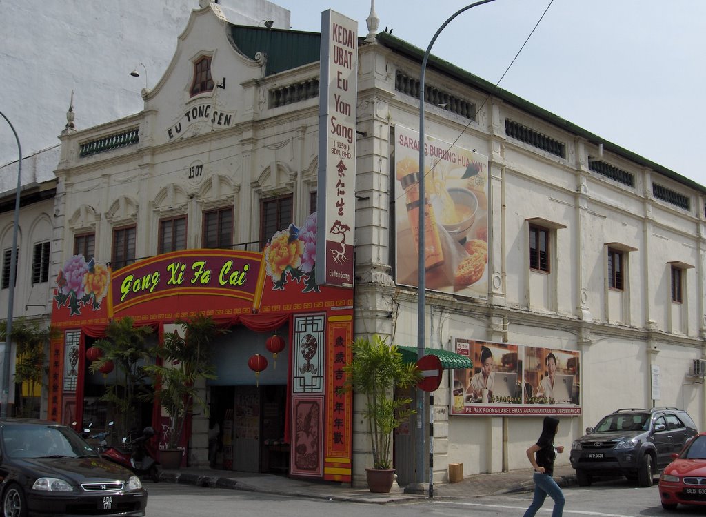
This building in Ipoh Old Town built in 1907 is the Eu Yan Sang (余仁生) Chinese medical hall. It has been dispensing TCM (Traditional Chinese Medicine) to the folks in Ipoh for the past century. It is located in the old town sector of Ipoh which used to a very busy area and the premier shopping district in town. It is the hall mark of EYS to have it’s shops set up in shopping center of the town.

Eu Yan Sang first started business in 1879 by Eu Kong (余广) who migrated from China, in the mining town of Gopeng which is located about 20km south of Ipoh. The medicine brought cure and relief to the early migrants, the miners and coolies. Since then it has established itself a standard of quality in TCM that is the evny of other Chinese medicine pharmaceutical chain.

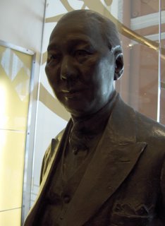
When the business was passed on to his only son Eu Tong Sen (余东旋)it expanded quickly. Eu Yan Sang medical halls sprang up in the major towns and cities in the Peninsula, in Ipoh, Penang, Kuala Lumpur, & Singapore.

Eu Tong Sen generously donated to support the cause of education in the region. His name is still remembered in ACS Ipoh, as one of the five competing sports team is named after him. (my first primer)

The EYS Medical Hall in Singapore opened in 1910. It is located along South Bridge Road, and was renovated a few yesars back. It is possibly the only building along that stretch of road that is still engaging in the original trade it was set up for. TCM is back in business and still going strong.


This statue of Eu Tong Sen (1877-1941) is standing inside the South Bridge Road building.


-//--

Sunday, February 26, 2006

the mining outpost - tin

Ipoh is often referred to at the town that tin built and naturally you would find a street named Jalan Bijeh Timah. (Bijeh Timah – means tin ore in Malay). This street is located in the older section of Ipoh – the Ipoh Old Town, on the southern bank of the Kinta River. This was the center for collection and transportation of tin to the Straits Tin Smelters in Butterworth. There used to be a congregation of shops for tin collecting agents in this area.

Ipoh started off as an outpost for tin ore collection, and it was probably the furthest point upstream where the bigger boat could navigate up the Kinta River. The Kinta River is a tributary of the Perak River meanders in the south-westerly direction to join the sea & the Straits of Malacca. Since the 1500s when the Portuguese and Dutch seafarers first appeared in the Straits, tin ore has probably traveled along this route to the sea.

In the old maps, Ipoh was spelt Epoh, which is the name of a tree. (Similarly Tampines is the name of a tree). The Epoh tree produces poisonous sap which was used by the orang asli (natives) to lace the dart of their blowpipes for hunting. A sample of the Epoh tree is planted in front of the Ipoh Railway Station.

Prior to it being called Epoh, the place was known as Paloh. There exist to this day a Kampong Paloh situated at the confluence of the Kinta River and Sungei Pari. The local Chinese still refer to Ipoh proper as 'Ba-Loh'.

Dotting the Kinta Valley were rich tin mines. The migrants came from afar to seek their fortune. At the turn of the 20th century, the tin industry boomed when tin found its use in plating metal can. The tin can stores food safely and over long period. It was a modern technology and a novelty then. That was when tin and tin got connected.

Tin is also used extensively in the electronics industry as solder for soldering the integrated-circuit chips onto printed circuit assembly boards. The latest foray of tin is into the fashion industry. The Royal Selangor Pewter has been promoting male ornaments made from pewter – an alloy which composed of more than 98% tin, and the rest lead and copper – for the hip and metrosexual.

Since the collapse of the tin industry nearly twenty five years ago, when the industrialized countries released their stockpile of tin cos of an attempt to corner the tin market, Ipoh stagnated. It was no longer the bustling and busy town it used to be. The town center has hollowed out. The center of activities moved to the northern sector of the city closer to the North-south highway and to the population to the townships that fringe the city.

The downturn has also been a blessing in disguise for the town of Ipoh – rows and rows of shop houses are in their original environment, and architecturally the town center has been left much intact. Many of the shop houses in the old and new town sectors are close to a hundred years old. They are still standing firm & solid, though looking weather beaten, worn and forlorn. They exude and old charm that that had seem better days.

Because the town has kept it’s original state when one is back there, one has a deep sense of connection to the place. Folks who had left Ipoh half a century ago and return for a visit today would still be able to recognize the city and its buildings well. The old cinemas are still standing, though no longer in business. The stall that sells the famous Ipoh hor fun is still in the same coffee shop selling the food.

Epoh beckons....

old charm that never fades - one of the side lanes in old town sector


-
-/...

Wednesday, February 22, 2006

the wedding photo

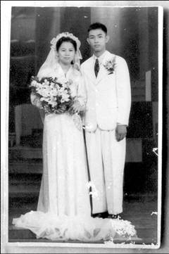
Found this old wedding photograph of mum and dad among the old alums in the study. As with the wedding custom of the era, the bride was in the all white wedding gown and the groom in a Western suit. On the surface this wedding photograph was no different from those that were taken from that era - in the 1930’s and 40’s.

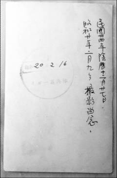
However, on turning over the photograph and examining what was written behind, it threw more clue and light. The two rows of words in Chinese stated that it was taken for remembrance on - the 34th year of the Republic, 27th day of the 12th lunar month, and Showa 20, February 9th.

The picture was taken 61 years ago to the month, during the Japanese occpuation of Malaya and Singapore in World War II.

The tradition of counting years among the folks then was the same as that in China, namely with 1911, the begining of the Republic as Year 1. And as for Showa, it followed the Japanese tradition of counting the years using the reign title of the emperor. 1926 was the start of the reign of the Showa Emperor and considered as Year 1.

The faded words in the chop, read: SHOWA 20.2.16, and the line below it was printed: IPOO KEMPEITAI. Heaven! This wedding photograh had been inspected and approved by the Kempetai, the Japanese Imperial Army.

The likely scenario on how the chop came about: It could have been, that after the photograph was developed, it was taken to the Ipoh Headquarter of the Japanese Imperial Army, The Kempeitai, (宪宾队) , to have it approved. Thus to be politically correct, the Showa reign year had to be on it. Or the photograph could have been taken at a Kempeitai approved photo studio on the wedding day of 9Feb, and after it was developed a week later, it was stamped with the chop of approval and released to the couple.

Six months after the Ipoh Kempeitai had chopped and approved this wedding photograph, Japan declared unconditional surrender to the Allied Forces of the Far East. This brought an end to three years and eight months of suffering and terror.


Side-note:
Each February Singapore marks the anniversary of the fall of the city to the Japanese Imperial Army, on Chinese New Year's day - 15Feb 64 years ago, as Self-Defence Day. The motto - 居安思威 (in peace, ponder danger) .


./...

Monday, February 20, 2006

where it all began

The lingo of ‘returning to one’s village to celebrate the New Year’ (回乡过年) will not ring a bell to the average folks in this country, unless he or she works or studies abroad and return to celebrate the lunar festival with the family or is married to someone out of this country.

Since leaving the hometown close to thirty years ago to study, work and subsequently to make this city my home, returning to the hometown to celebrate the New Year has almost been an annual ritual.

Returning to the home & the hometown for the CNY is an opportunity to rediscover childhood memories, research on my roots, to renew bond with my siblings and families, and with the place that I nurtured my formative years.

The family history is for one to discover and each CNY is a time to dig thro the old albums, the corners and crevices in the study, and hunting for new finds in the antique safe. In the foner of the top shelf in the study, there is this box of genealogical records (古氏族谱) which is nearly 80 years old. It has been a ritual to open it when I'm back home, and to browse thro the pages to rediscover ones root. Mine is the 38th generation from the line of Ge-Gong(革公派)。

Away from the hustle and bustle of city life, the occassion would give me a chance to reaffirm my existence, pondering fwhere the ancestors were from, why they migrated to this part of the world, what their bonds were with the ancestral village then, and reflect on the immediate and extended family. The past is so much linked to the present, and the present will be the past of the future.

The ‘archeological dig’ thro the pile of old records and photographs, was rewarded with this find of a document that is nearly 60 years old. The Chinese word Singapore was written on it.

What has this 60 year old document to do with Singapore? It was found among the pile of old records and photographs kept in an antique safe,

This was the disembarkation document issued to Overseas Chinese returning to China - 侨民回国登记 – by the Chief of the Overseas Chinese Bureau in Swatow –( 汕头侨务局局长). The port of embarkation was Singapore (由何地回国 : 星加坡)

The traveler was dad when he was 25years old, and on his last trip to his ancestral home before Mao declared a new China six months later. It will be more than 45years later before he made his next trip again back to the village.

His trip was the last of the continuation of trips which started way much earlier passing thro Singapore as the port of embarkation and disembarkation, thro and from Ipoh 怡保 & the village in China, Songkou / Meixian (松口/梅县 -using the std pinyin). The trips started probably sometime around the later part of 1800s or the beginning of 1900/s when his dad first came to the South Seas (南洋) .

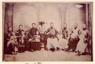
The photograph below was taken during that era. It was a family portrait of the 35th generation, probably taken in China. Singapore would have been their port of embarkation and disembarkation to and from Epoh. During their stay in Selatpore, (石叻坡 – old Chinese name for Singapore ) while waiting for the next ship to leave port, they would have visited Yin Fo Association along Telok Ayer Street, to catch up with their fellow Hakkas.
(country club by telok ayer street)


./...

Saturday, February 18, 2006

my first primer

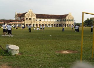
My Alma Mater , as it was just next to the bus terminal, I dropped in for a visit on arriving in Ipoh. There is a side entrance to the school from Kidd Road, while the main entrance faces Lahat Road. This main building build in Edwardian style of the era, was ‘ erected to the Glory of God and for the advancement in knowledge of the youth of Perak’. The foundation stone was laid by Oliver Marks Esq. acting British Resident Perak on August 1st 1912, and opened on March 30th, 1914 by Sir Arthur Young. The builder and architect was CH La Brooy.
The school celebrated its 110 anniversary last year, 2005. It was founded by the Rev. Horley as a Methodist Institution in the new mining township upcountry of Epoh. During school Sports Day the students are divided into five competing teams, namely Horley, Oldham, Aziz, Tagore, Eu Tong Sen. Horley is in memory of the founder of the school in Ipoh, while Oldham was in memory of Rev William F Oldham, the founder of the Anglo-Chinese School, Singapore in 1886, where it was first located at 70 Amoy Street.

Behind the school is the railway track . The railway runs thro the Peninsula, south to KL-Singapore, and North to Penang-Bangkok, and in future possibly to Hanoi and then to China as part of the trans-Asean-China track. The railway line is under construction to a double carriage track. The work has been going on for some years. We used to see the train passing by in the moring and evening having our PE classes in the field. The building in the background is the school hostel.


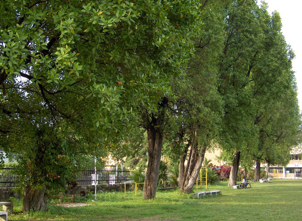
These Tembusu tress that lined the side of the field facing the road leading to the primary building, must be as old as the school. These trees were considered old when I first entered the school. I could remember the trees well because when I was in Standard Three, we used to play police and thieves there among the trees while waiting for the afternoon class to start.

The buildings in the school have not changed much over the years and since I left 30 years ago. They looked a little worn & weather beaten though, and now with a heavy fence around the school perimeter, the buildings and fields seem caged in, and it did not seem to be the open and spacious school compound that I used to remember.

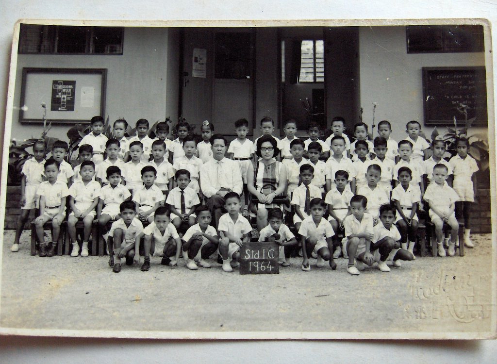
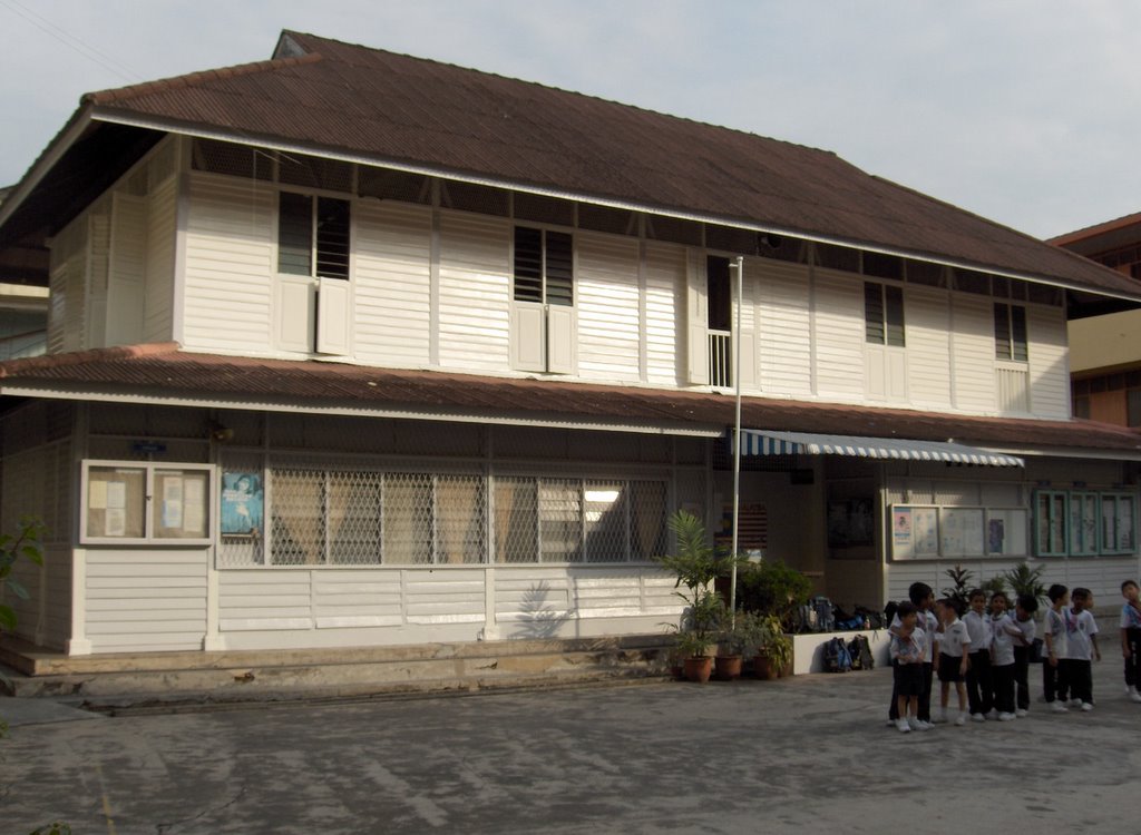
This wooden building is the original site of the school where it first began. It is now possibly the oldest wooden school building in Ipoh. My Standard One class room was on the upper floor towards the left of the building. The photograph below was the class of Std IC taken in 1964. (I found it among the old albums in the study). The class teacher was Mrs Cheah Chan Yew, and the Senior Assistant, Mr Foo Choy Wan, was also a very strict, fierce but kind-at-heart discipline master. It was a big class of 50 pupils.


The class of pupils had a good ethic mix and the boys study, play and 'f'ight' together amongst themselves. The Malay boys came from Kampong Paloh nearby, the Indian and Sikh pupuils from Buntong, and the Chinese from the town and township nearby.

This is the model for the Vision School that the Malaysian government is promoting. I certainly have learnt cultural diversity and ethic harmony in my formative years, thanks to my fellow pupils. I recall that the first Prime Minister of Malaysia, the Tengku used to mention that he was the proudest and happiest PM in the world cos his countrymen lived in ethnic harmony and peace.


/--

Friday, February 17, 2006

the journey home up north

Homeward bound for the Lunar Never Year and arrived at the Kidd Road Ipoh Bus Terminal at 5:00pm on 26Feb006/Thursday. Left Tampines in the early hours at 5:30am , on the first bus out to Sungei Road terminal to take the Singapore-JB Express. From JB Tampoi, hopped onto a KL bound bus leaving at 8am & reached KL Pudu Raya Bus Terminal at 12:30pm. As the next bus leaving for Ipoh was at 2:00pm, had lunch at KL Chinatown, which was about 10 minutes walk away from the bus terminal.

All in the journey from home in Tampines to home up noth took 12 hours. On the return trip to the Singapore, the flight from Ipoh to Senai/JB took only 45mins! It’s a yearly ritual to take this mode of transport back to my kampong up north. Why the hassle of a 12 hour journey when you could cover it in 3? Well, its all for the sentiment.


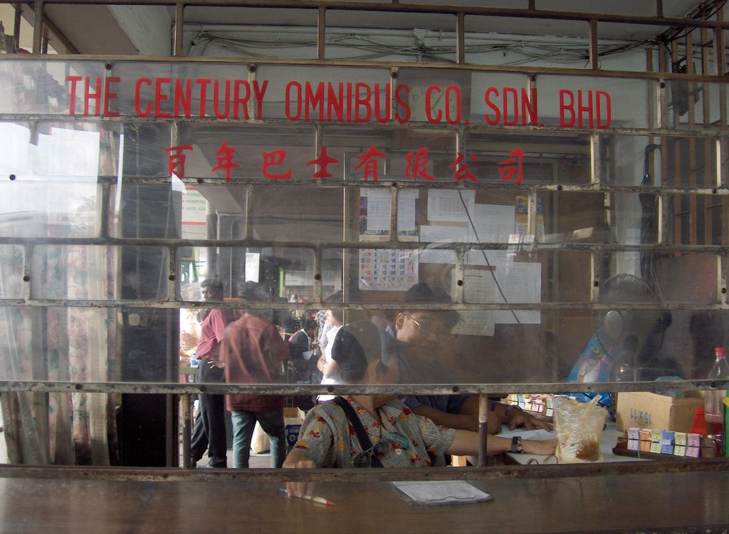
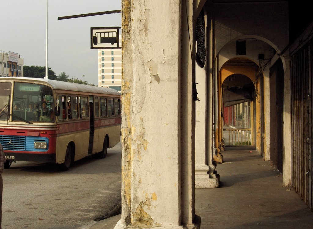
The Century Ominbus Co Sdn Bhd is one of the main tenants of the bus terminal. Its buses that ply the town route have a red stripe painted horizontally across the middle. The town folks affectionately call it the ‘red bus’. Then, it was the most popular mode of public transport to and from and within the old and new town. The number of commuters has dwindled drastically over the years with increased car ownership. The buses that are plying the city now may have a long while more to reach a century of service. However they easily qualify for a half century of loyal & long service award.


The Kacang Putih man at the bus terminal is still there, and these are some of the many scenes that you can still find in Ipoh that has remained unchanged for the past 50 years! The century old shop houses are still intact, and the hawkers are still plying their trade in the same way as their fore farthers have been doing it. I remember seeing the Kacang Putih (peanut) man in one of the Singapore History Museum open house events - down memory lane. Well folks, if you want to see the real one and in the true environment, travel up North. It’s worth the 12 hour bus ride. Better still, fly and you can be there for lunch and back for dinner.


/--

Wednesday, February 15, 2006

in all its natural splendor

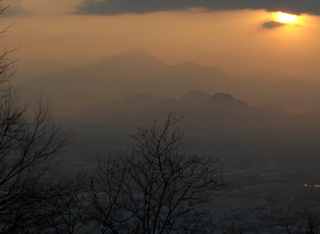
It’s dawn over the Kinta Valley on the 2nd day of the Year of the Dog, 30 Jan 2006. The picture was taken from the Kledang Hill at an elevation of about 350m. The distant peak is Mt Korbu, and at 2183m is the highest peak in the state of Perak, and the second highest in the Peninsula Malaya. It is on the Main Range which forms the backbone of the peninsula land mass. Cameron Highlands, the hill resort is located yonder in the distant behind this range.


This range stretches all the way down south to the state of Johor, with Gunong Leadang @ 1276m, its highest point. Gunong Ledang is more popular known as Mt Ophir to the folks from the City State.


Kledang Hill has become a very popular spot for morning and evening walks for the folks living in the valley, specifically from the Ipoh Municipality.

Menglembu, my childhood home town is located at the foot of the hill.

As if it is an annual ritual, each year when I went back for the Lunar New Year I would venture deep into the woods, in the mountain - to enjoy the cool and refreshing streams and waterfalls, and be one with nature.


The track up the hill is steep and winding. It used to be hard mud path, but in recent years concrete steps have been laid to help the climbers walk safely. The are also pavilions doting the road side up the hill and for one to rest.

./...

Sunday, February 12, 2006

to walk and to feel

That’s the only day where one can walk barefoot in the heart of the city and nobody will look at you twice and thinks you crazy and absurd.

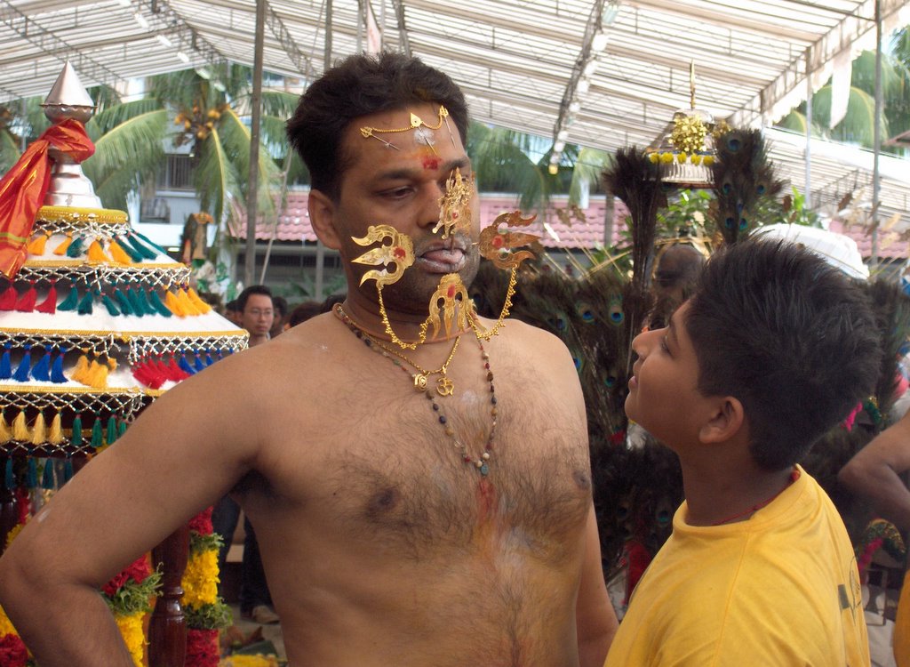
The occasion was the Thaipusam festival, and having to remove one’s shoes to enter the temple in Serangoon Road, I continued to join the believers on their path of penance and faith all the way to the Chettiar’s Temple at Tank Road.

It was my little penance of sort, and my poor tender feet has to bear the occasional pain of stepping on little stones along the way. However, the tarred road also provides a reflexlogical effect and I find it could be therapeutical walking without shoes on.

Thaipusam day should also be promoted as a day to walk in nature (gosh, heaven forbid!) – that is leave behind your branded footwear and walk with your natural bare feet. The believers do it I believe as a sign of respect for the gods. Feel the ground that you walk daily, touch it and have a bond with it directly. The city streets are clean and safe enough for that.

If the Singapore tourism promotion board has run out of ideas to promote a uniquely Singapore, this is one to consider. Fellow citizens and tourist alike could partake in the cultural fest and take time to feel and bond with the road that they walk.


Thaipusam - it's also a unique occassion for father and child bonding.


/....